Maps of The Society for the Diffusion of Useful Knowledge 1829-1844
ForumMaps and Atlases
Melde dich bei LibraryThing an, um Nachrichten zu schreiben.
1wcarter
Complete collection of the hand-coloured Maps of The Society for the Diffusion of Useful Knowledge 1829-1844
A significant player in expanding access to geographic information in the 19th. century was the whimsically named Society for the Diffusion of Useful Knowledge.
The Society was founded in 1826 in London as a non-profit publication house aimed at disseminating useful knowledge, to the masses of English society in language and formats that were understandable to the layman.
Shortly after the group’s founding, a Map Committee was formed to organize the development of maps and atlases. Led by Captain Francis Beaufort, the esteemed Hydrographer of the Navy and expert in nautical charting, the mapping project of the SDUK began producing atlases arranged by country and region. Despite the high quality of the maps in design and accuracy, the atlases required assembly on the part of the customer. Maps comprising parts of a single country were published in sporadic intervals over long periods of time, as they became available. Frustrated consumers would often have to wait years to receive all of the maps in a country series, in addition to a table of contents page that would instruct them on how to assemble the final atlas correctly. The long timelines for the completion of the map series were largely due to Beaufort’s uncompromising standards for accuracy and meticulous attention to detail. Because of this, despite all the planned maps being published, many sets were never completed, let alone bound.
The maps were priced at 6 pence, or one shilling if coloured.
Beaufort went beyond the role of editor, authoring most of the maps himself. He was a stickler for accuracy who largely preferred original maps drawn from unpublished sources to updated versions of pre-existing maps.
His dedication resulted in some of the most precise and well-engraved maps of their era. But perfection came at a cost: maps were often delayed for absurd stretches of time. The SDUK's two-part map of Ireland (Beaufort's homeland) took more than six years to complete.
His fastidiousness extended to the very end of the process. Found in the Beaufort Collection at the Henry Huntington Library, the corrected proof for the plate of Northern Ireland is cluttered with more than one hundred tiny, exacting corrections in Beaufort's hand.
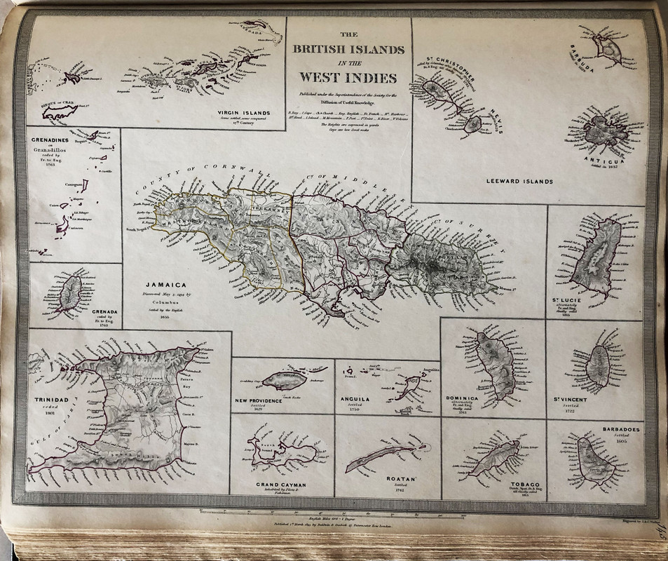
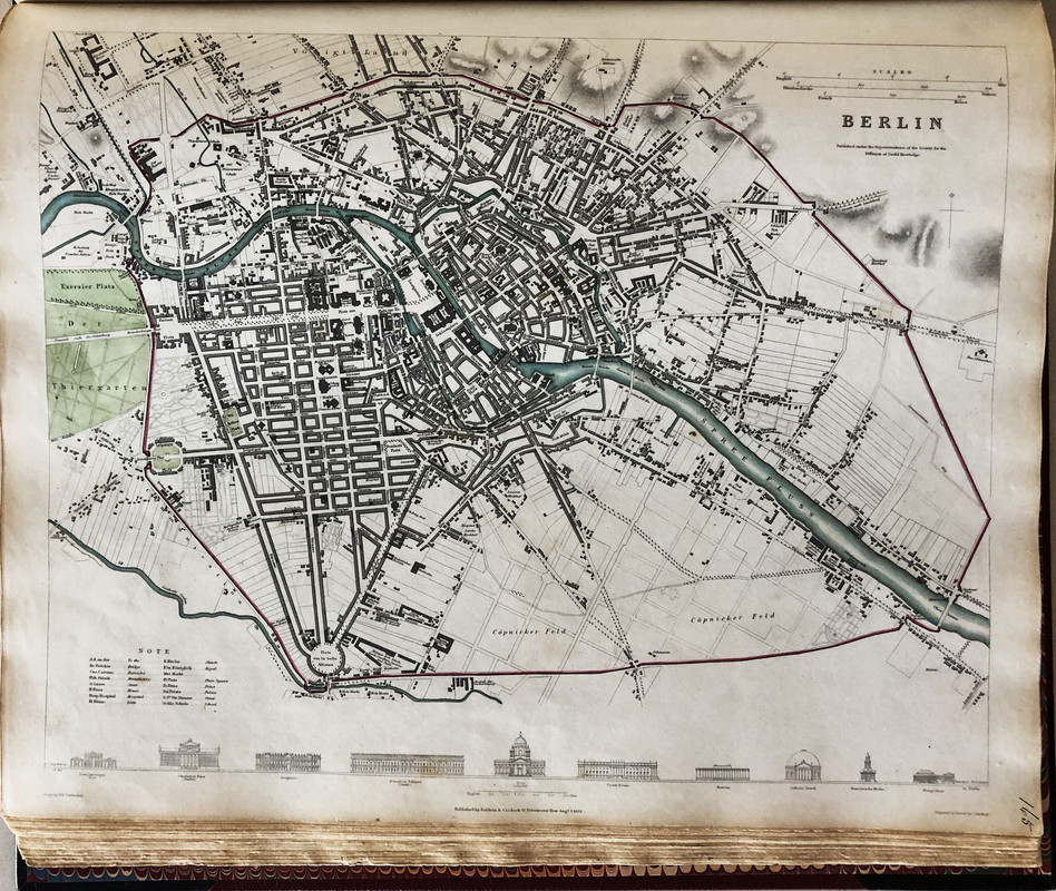
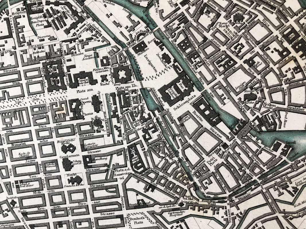
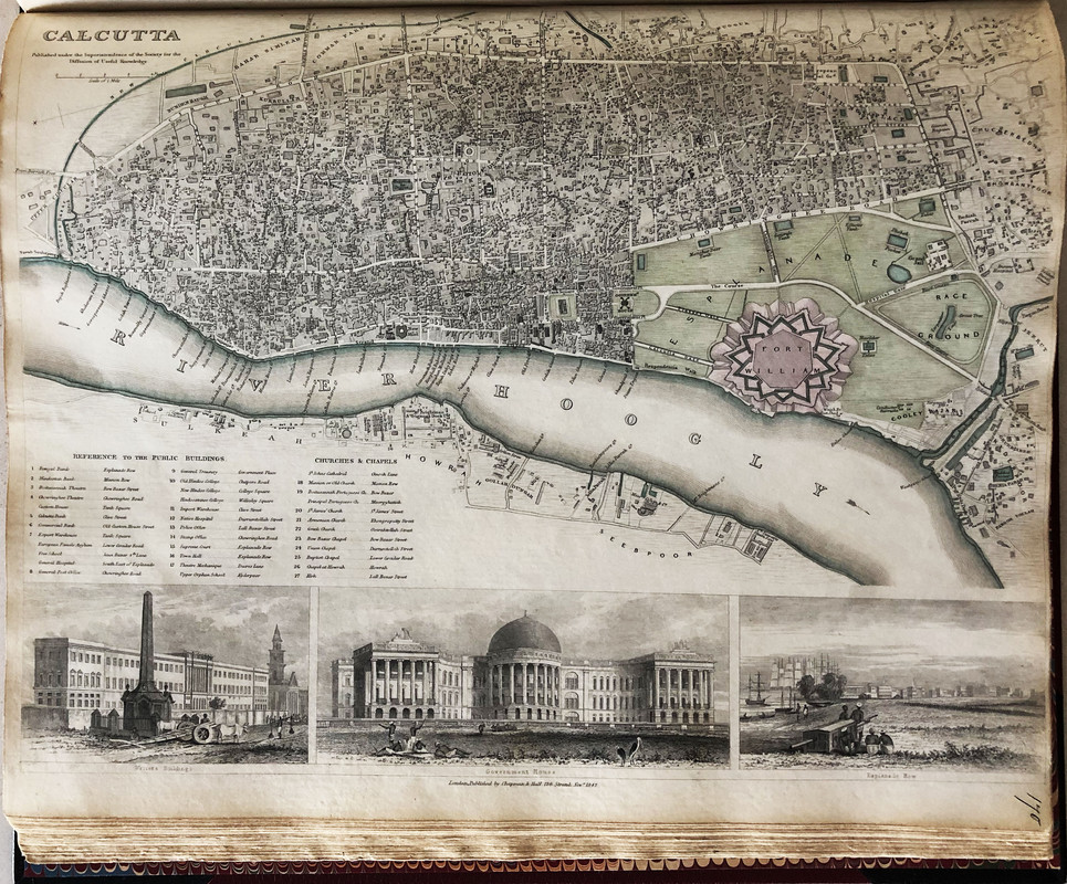
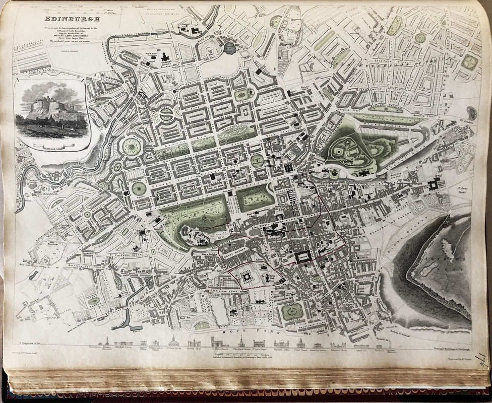
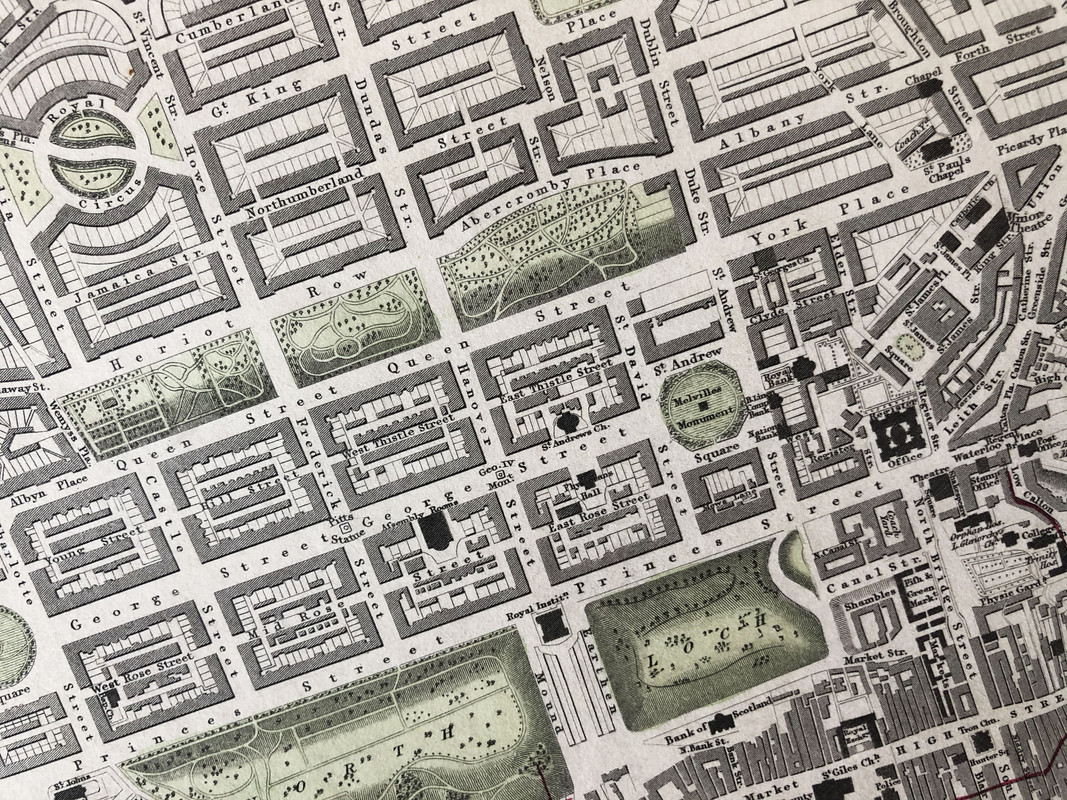
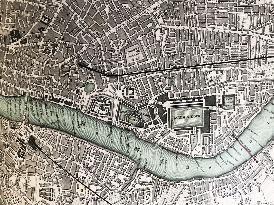
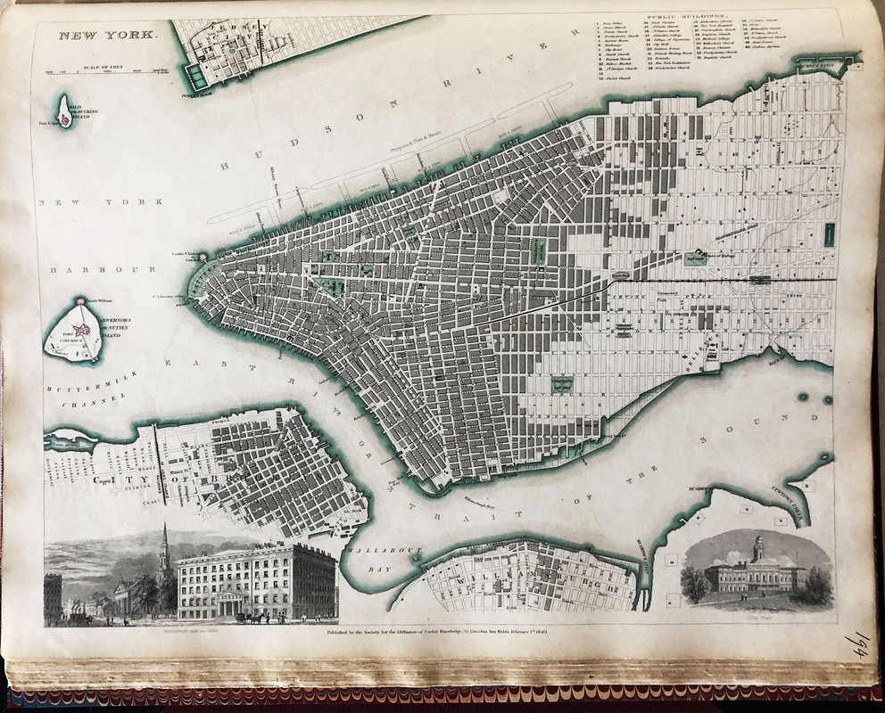
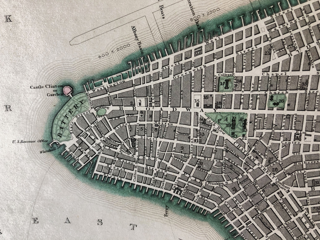
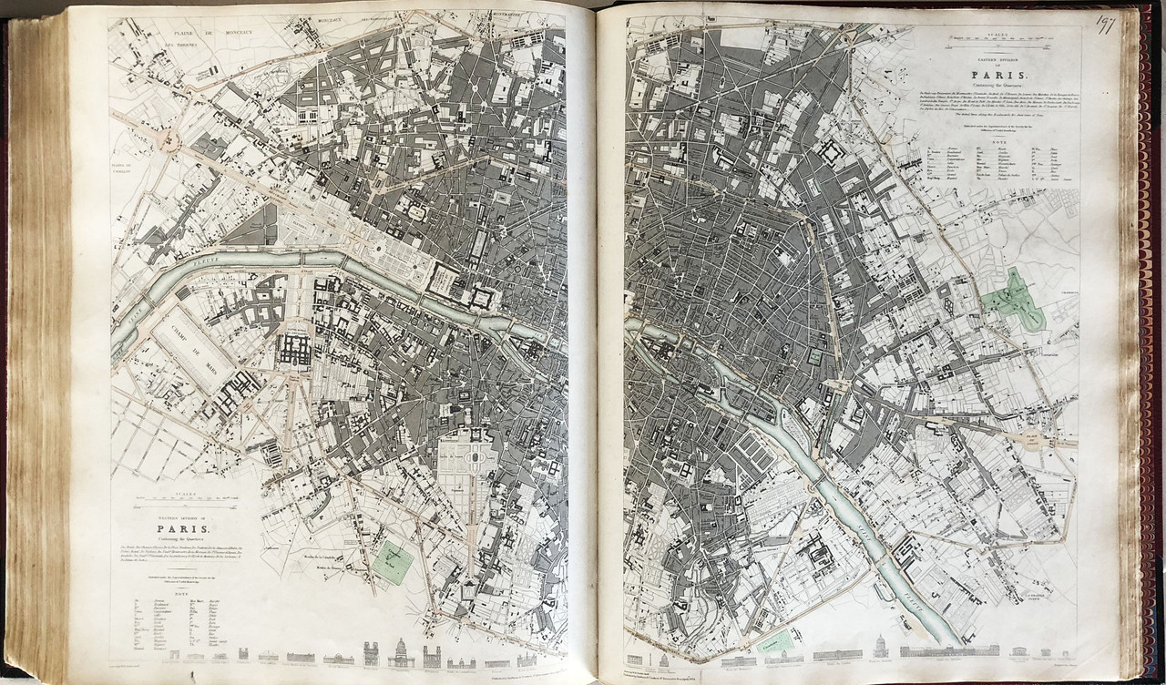
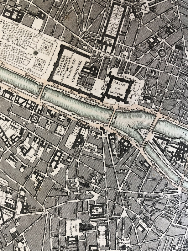
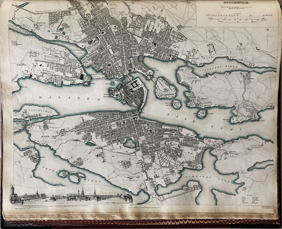
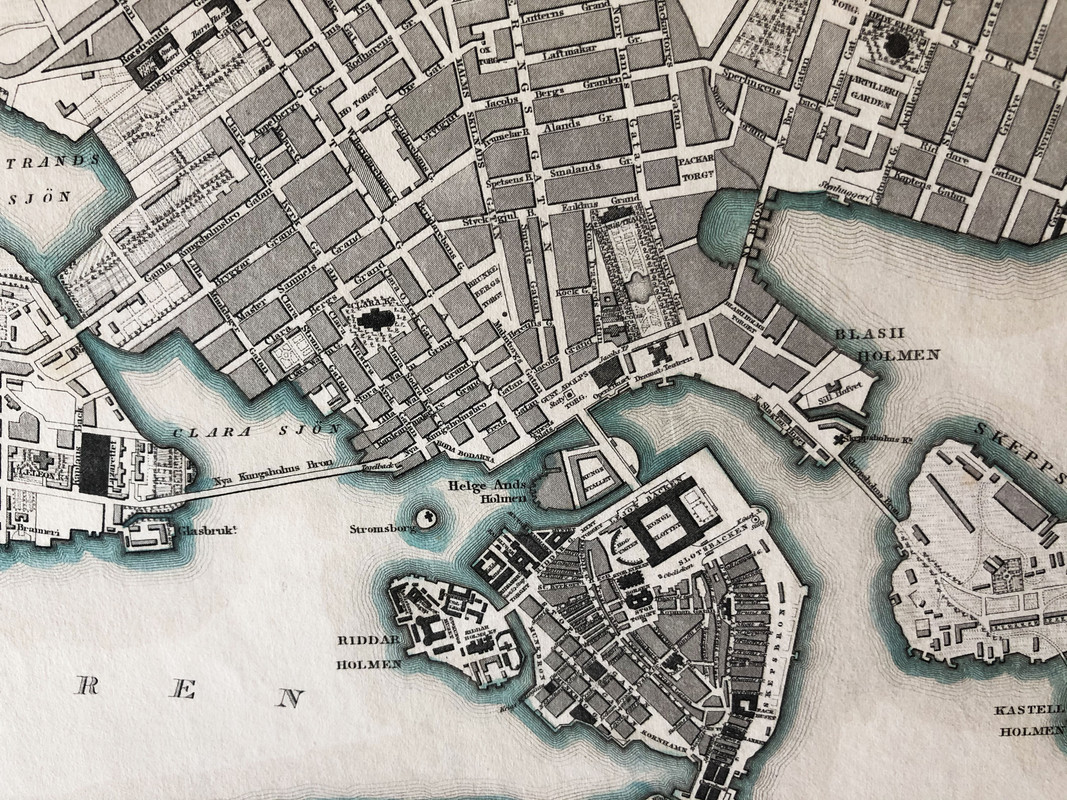
In addition to country maps, the SDUK produced detailed city maps. Many of the city maps included beautiful panoramic sketches of the city and scale-accurate diagrams of major landmarks drawn by architect W.B. Clarke.
The mapping initiative continued under different publishing schemes and was completed in 1844. The Society itself dissolved in 1848.
In the years after the SDUK’s closing and up to the present day, the maps produced by the Society are recognized as some of the most accurate and well-designed maps of the era. While the consumers of SDUK maps at the time were frustrated with the 15 years-long process of completing the country atlases, today we can appreciate the cartographic perfectionism championed by Captain Francis Beaufort. The Society for the Diffusion of Useful Knowledge certainly deserves recognition as innovators in the history of cartography.
The superbly and intricately engraved maps of the Society are now very much in demand, particularly when they are coloured, and sell from £50 to £500 each. The geological map of Britain is one of the most beautiful (and now expensive) maps ever produced, while the maps of the major cities are also in great demand. Bound full colour complete sets with all 218 maps are very rare and valuable.
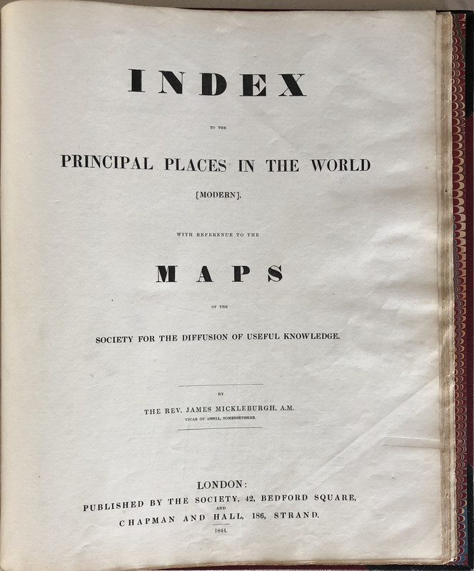
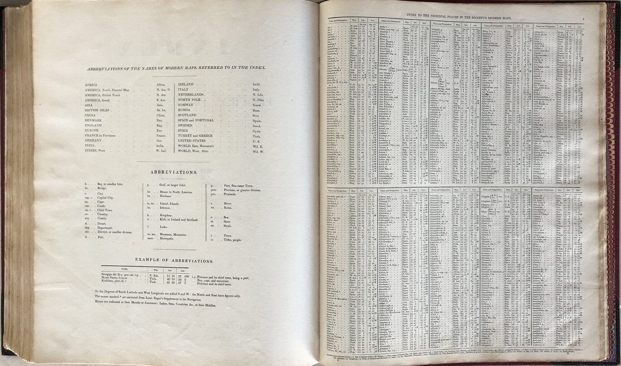
There is no introduction, preface or foreword, but there is a list of Committee Members and a Contents at the front, and an extensive Index. Volume one consists of the country maps, while volume 2 is the city maps. I have both volumes bound as one book. A few of the maps have small fold-out sections.
Unfortunately, most complete sets of these maps have been broken up by dealers, and the maps sold separately for framing.
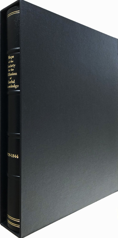
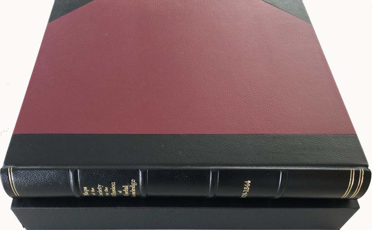
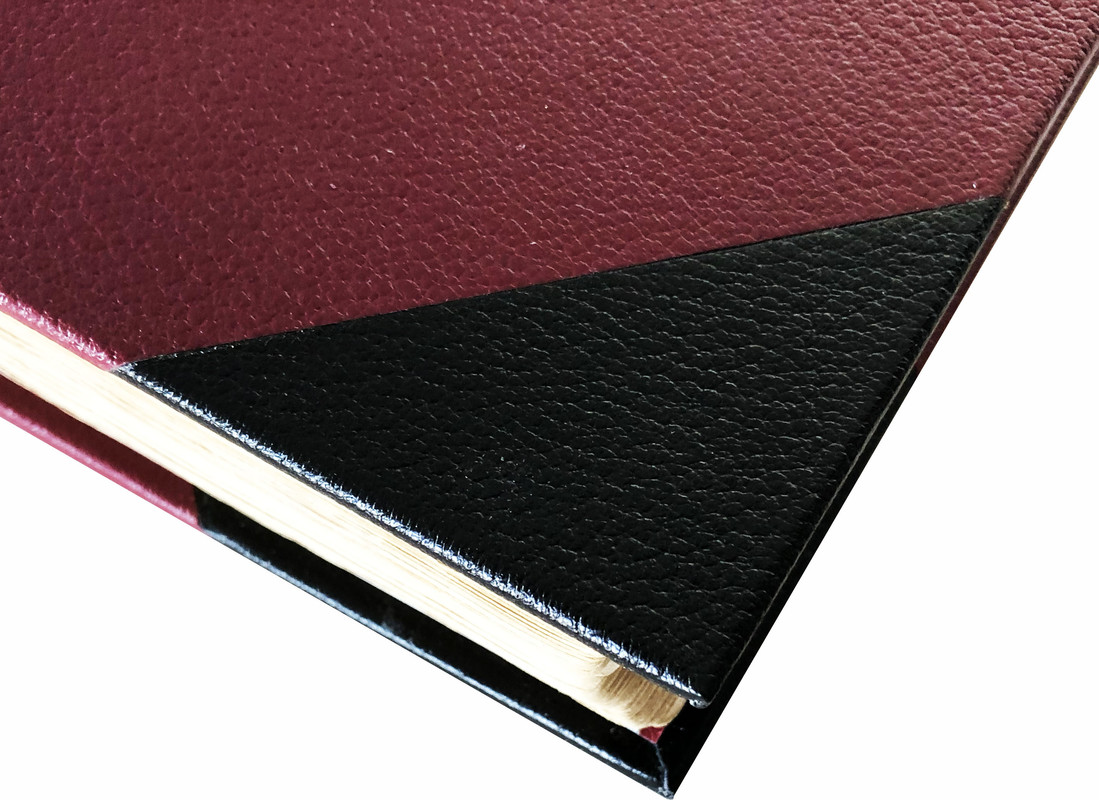
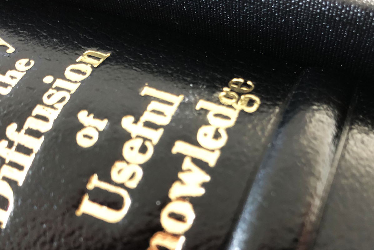
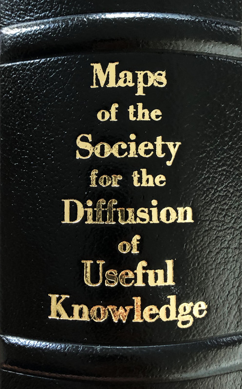
I own one of the very few complete sets of these hand-coloured maps in existence. They were originally bound in a rather tatty brown quarter cloth binding with card covers. I felt it deserved much better, so had the volume rebound in full Nigerian goatskin – half in black with maroon covers and ribbed spine with gilt titling. A maroon paper lined black slipcase (44x37.5cm.) was also made for it, and French marbled endpapers added. I now feel the binding matches the contents.
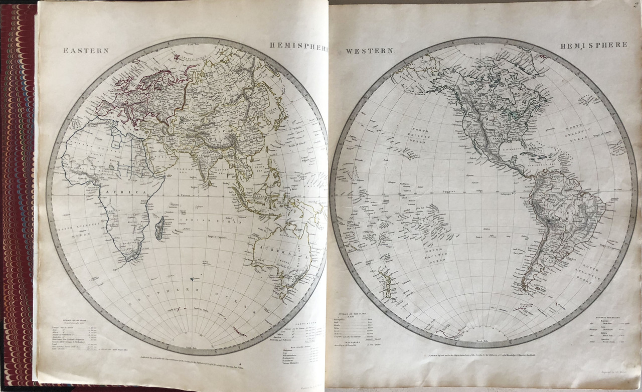
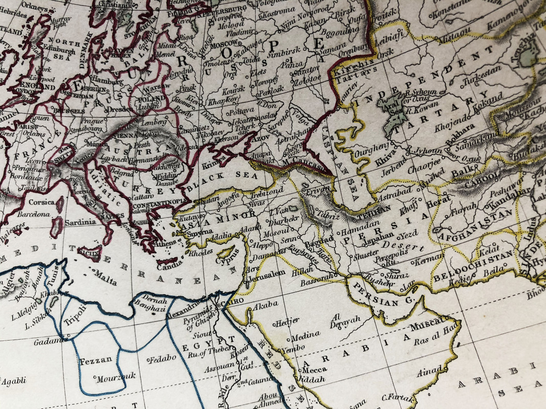
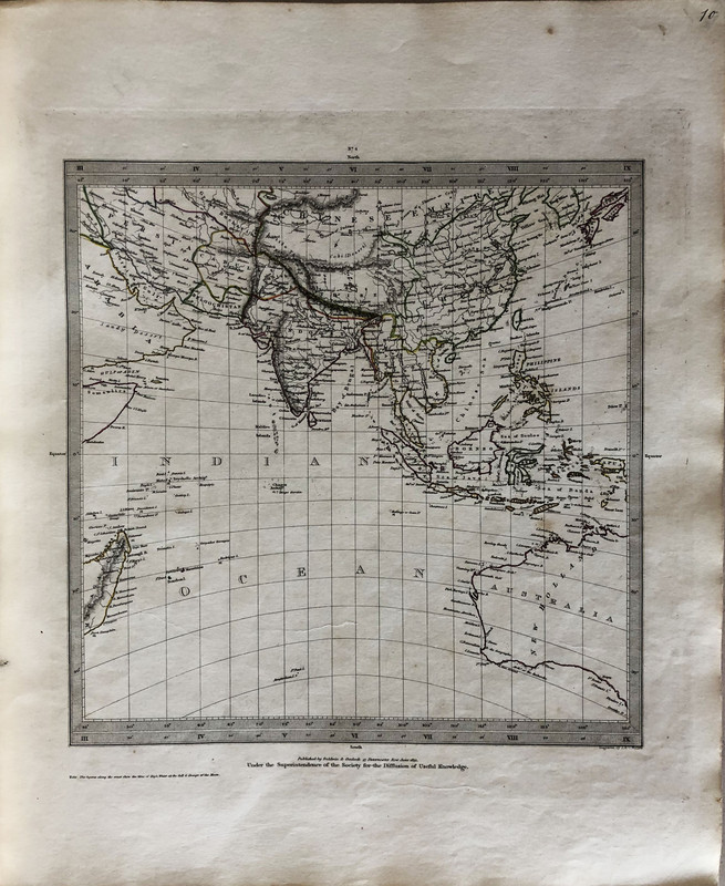
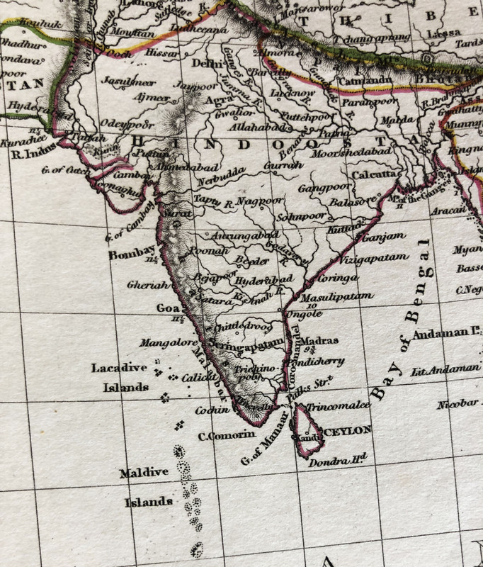
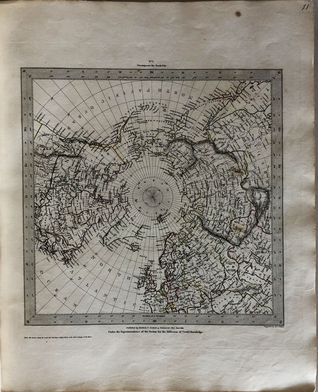
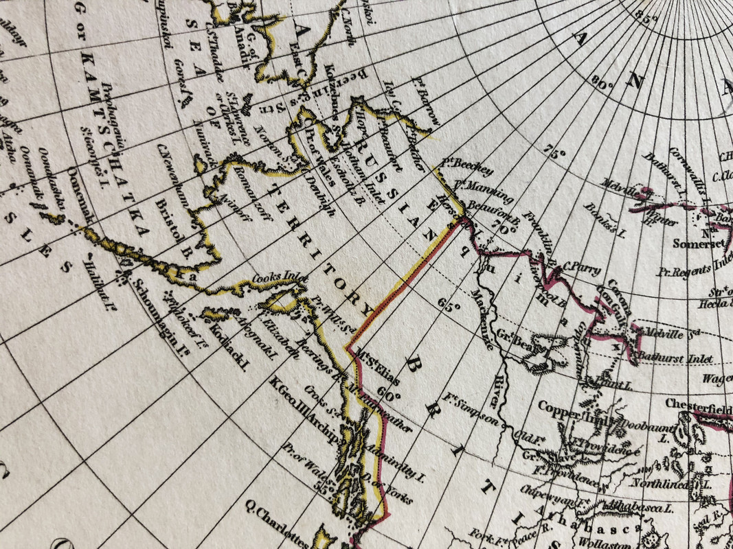
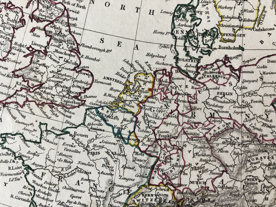
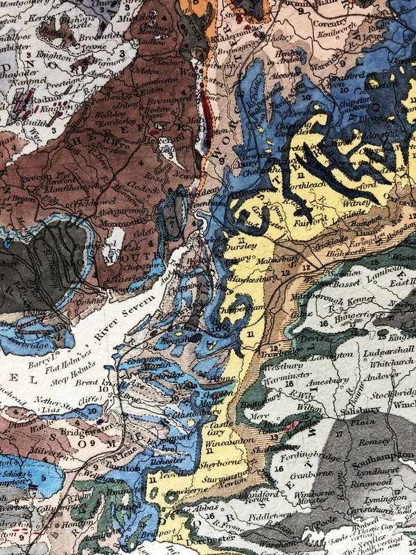
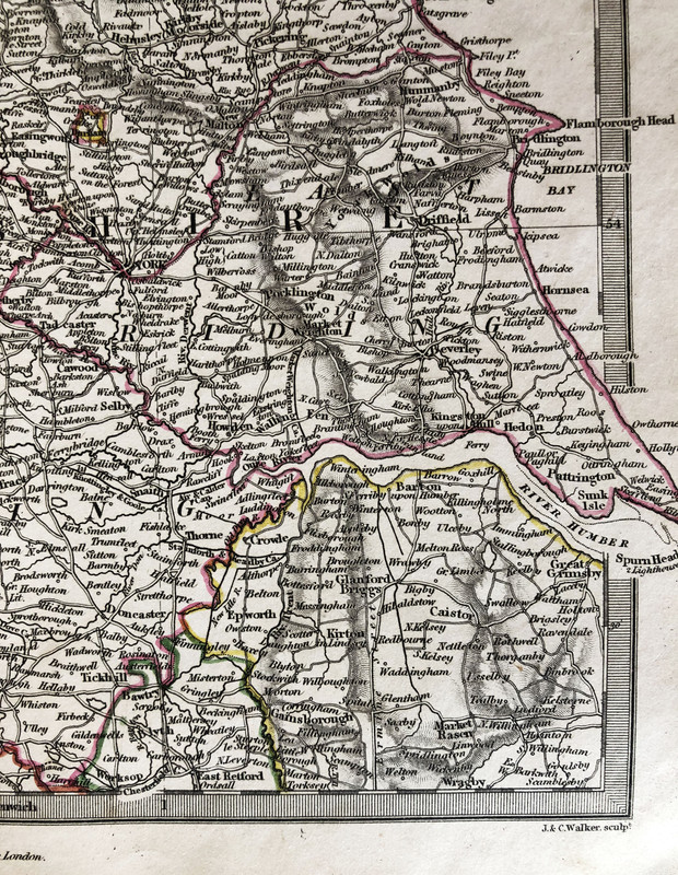
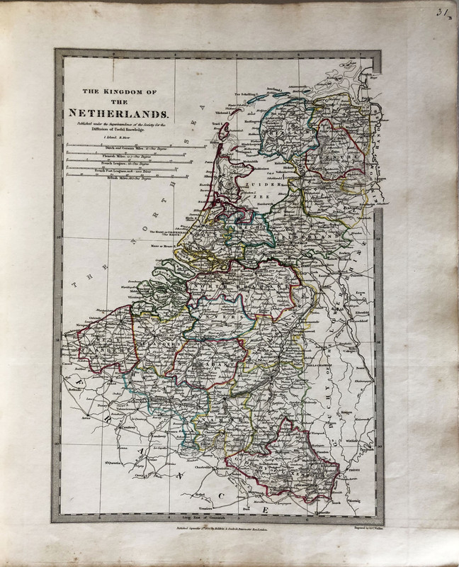
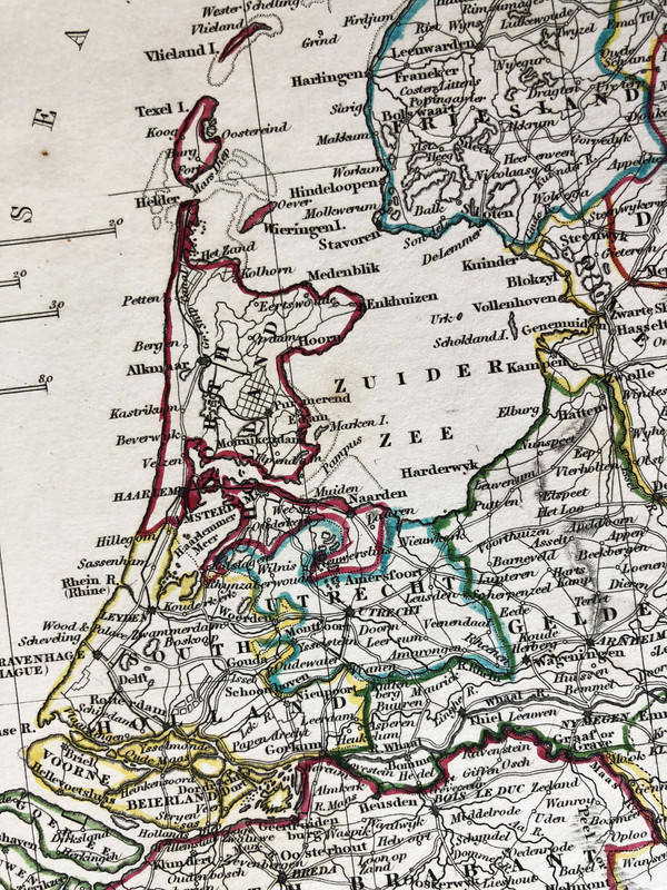
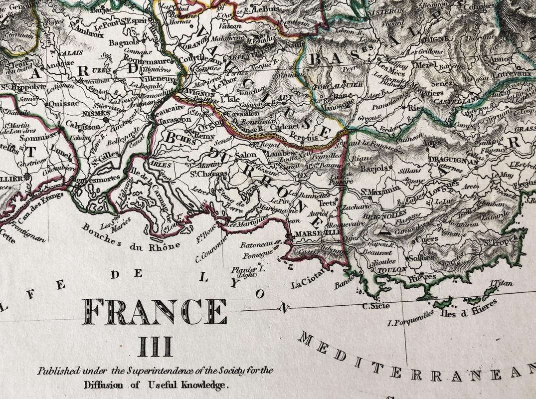
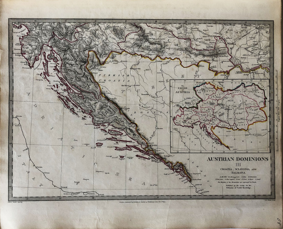
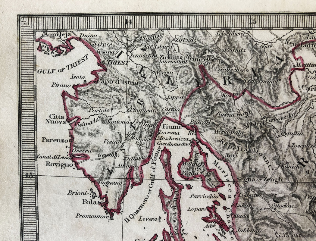
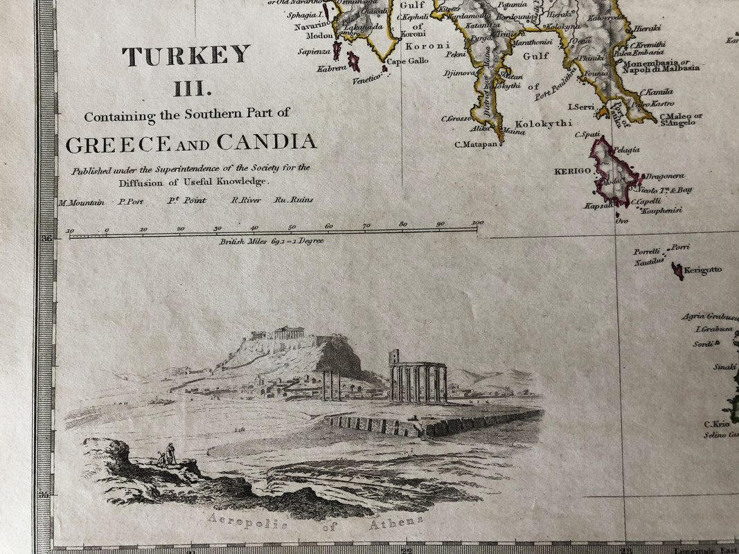
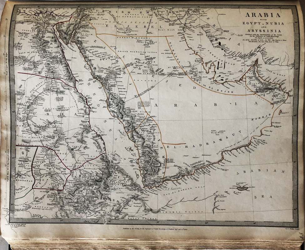
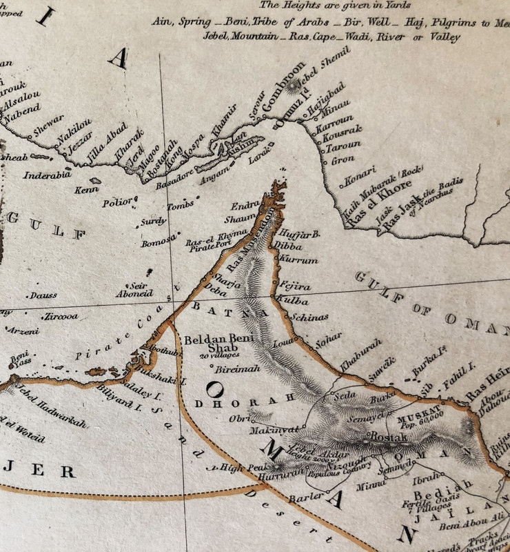
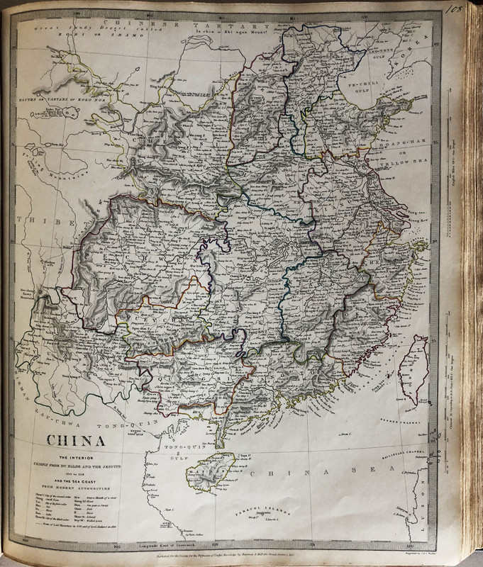
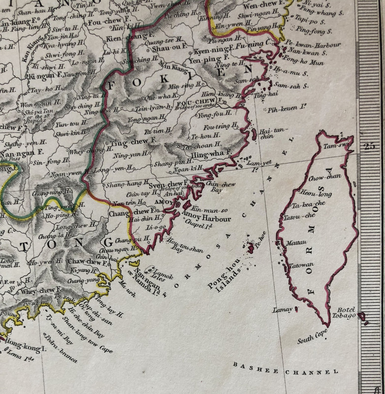
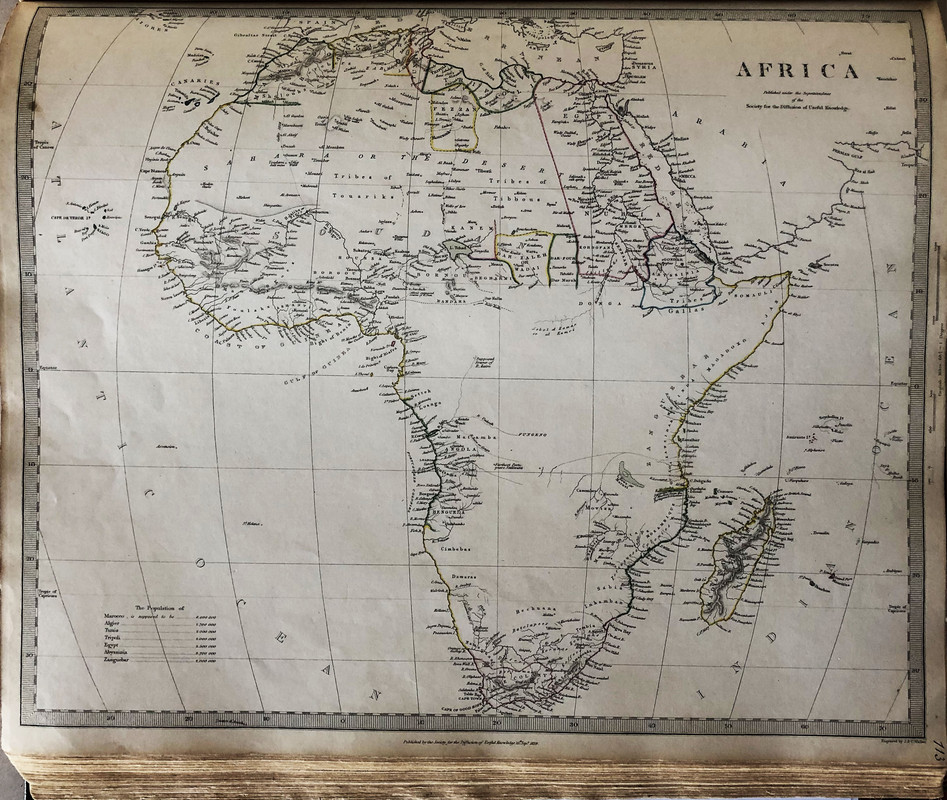
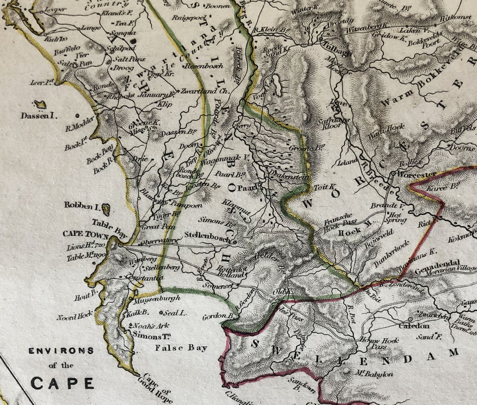
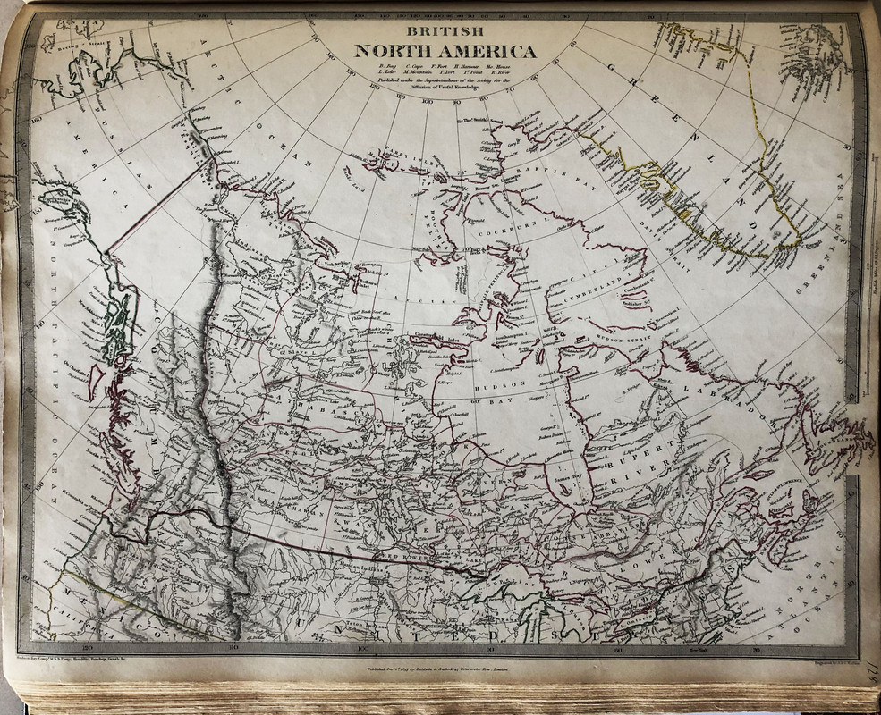
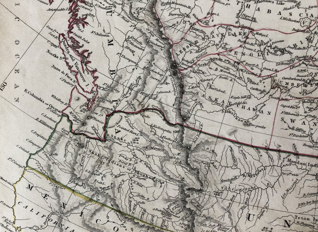
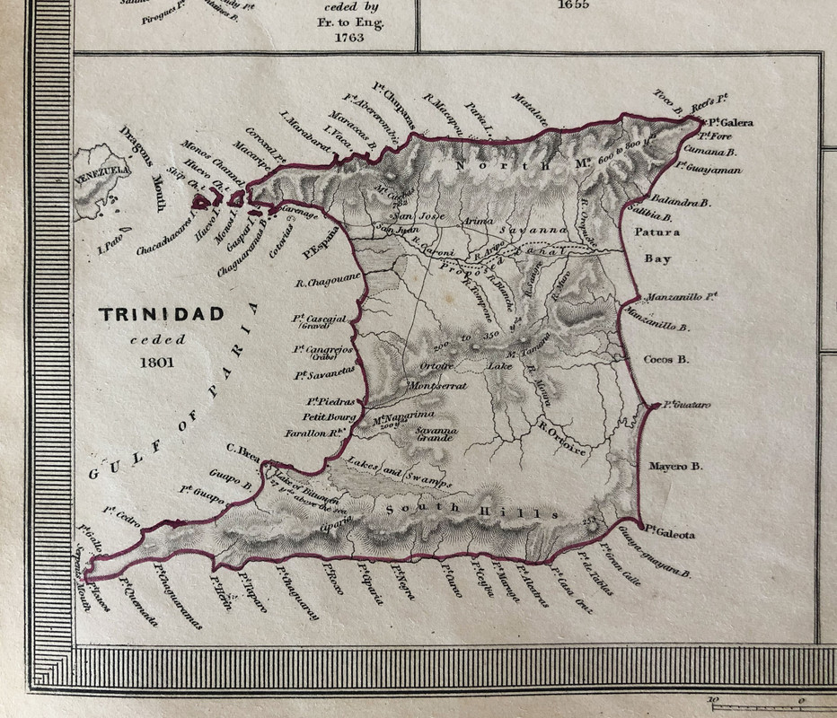
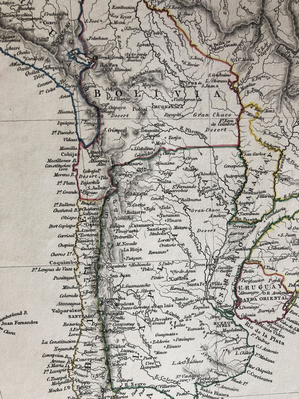
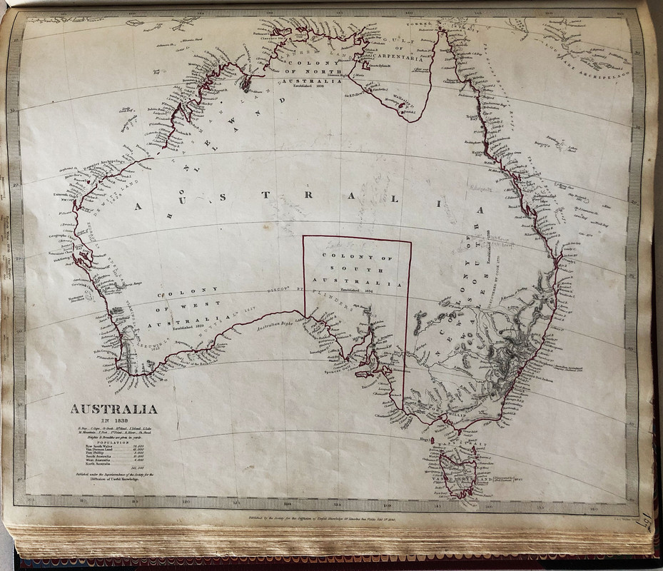
In the maps below, each map photo is followed by a detailed picture of one small area of that map.


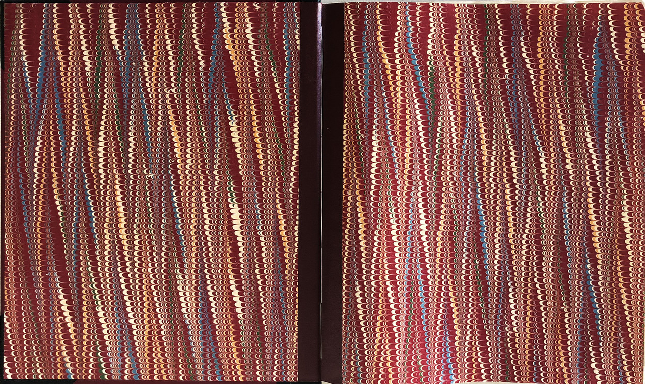
Endpapers


Geological map of England and Wales

Folded-in map extension


An index of the other illustrated reviews in the this series can be viewed here.
A significant player in expanding access to geographic information in the 19th. century was the whimsically named Society for the Diffusion of Useful Knowledge.
The Society was founded in 1826 in London as a non-profit publication house aimed at disseminating useful knowledge, to the masses of English society in language and formats that were understandable to the layman.
Shortly after the group’s founding, a Map Committee was formed to organize the development of maps and atlases. Led by Captain Francis Beaufort, the esteemed Hydrographer of the Navy and expert in nautical charting, the mapping project of the SDUK began producing atlases arranged by country and region. Despite the high quality of the maps in design and accuracy, the atlases required assembly on the part of the customer. Maps comprising parts of a single country were published in sporadic intervals over long periods of time, as they became available. Frustrated consumers would often have to wait years to receive all of the maps in a country series, in addition to a table of contents page that would instruct them on how to assemble the final atlas correctly. The long timelines for the completion of the map series were largely due to Beaufort’s uncompromising standards for accuracy and meticulous attention to detail. Because of this, despite all the planned maps being published, many sets were never completed, let alone bound.
The maps were priced at 6 pence, or one shilling if coloured.
Beaufort went beyond the role of editor, authoring most of the maps himself. He was a stickler for accuracy who largely preferred original maps drawn from unpublished sources to updated versions of pre-existing maps.
His dedication resulted in some of the most precise and well-engraved maps of their era. But perfection came at a cost: maps were often delayed for absurd stretches of time. The SDUK's two-part map of Ireland (Beaufort's homeland) took more than six years to complete.
His fastidiousness extended to the very end of the process. Found in the Beaufort Collection at the Henry Huntington Library, the corrected proof for the plate of Northern Ireland is cluttered with more than one hundred tiny, exacting corrections in Beaufort's hand.
In addition to country maps, the SDUK produced detailed city maps. Many of the city maps included beautiful panoramic sketches of the city and scale-accurate diagrams of major landmarks drawn by architect W.B. Clarke.
The mapping initiative continued under different publishing schemes and was completed in 1844. The Society itself dissolved in 1848.
In the years after the SDUK’s closing and up to the present day, the maps produced by the Society are recognized as some of the most accurate and well-designed maps of the era. While the consumers of SDUK maps at the time were frustrated with the 15 years-long process of completing the country atlases, today we can appreciate the cartographic perfectionism championed by Captain Francis Beaufort. The Society for the Diffusion of Useful Knowledge certainly deserves recognition as innovators in the history of cartography.
The superbly and intricately engraved maps of the Society are now very much in demand, particularly when they are coloured, and sell from £50 to £500 each. The geological map of Britain is one of the most beautiful (and now expensive) maps ever produced, while the maps of the major cities are also in great demand. Bound full colour complete sets with all 218 maps are very rare and valuable.
There is no introduction, preface or foreword, but there is a list of Committee Members and a Contents at the front, and an extensive Index. Volume one consists of the country maps, while volume 2 is the city maps. I have both volumes bound as one book. A few of the maps have small fold-out sections.
Unfortunately, most complete sets of these maps have been broken up by dealers, and the maps sold separately for framing.
I own one of the very few complete sets of these hand-coloured maps in existence. They were originally bound in a rather tatty brown quarter cloth binding with card covers. I felt it deserved much better, so had the volume rebound in full Nigerian goatskin – half in black with maroon covers and ribbed spine with gilt titling. A maroon paper lined black slipcase (44x37.5cm.) was also made for it, and French marbled endpapers added. I now feel the binding matches the contents.
In the maps below, each map photo is followed by a detailed picture of one small area of that map.


Endpapers


Geological map of England and Wales


Folded-in map extension


An index of the other illustrated reviews in the this series can be viewed here.

